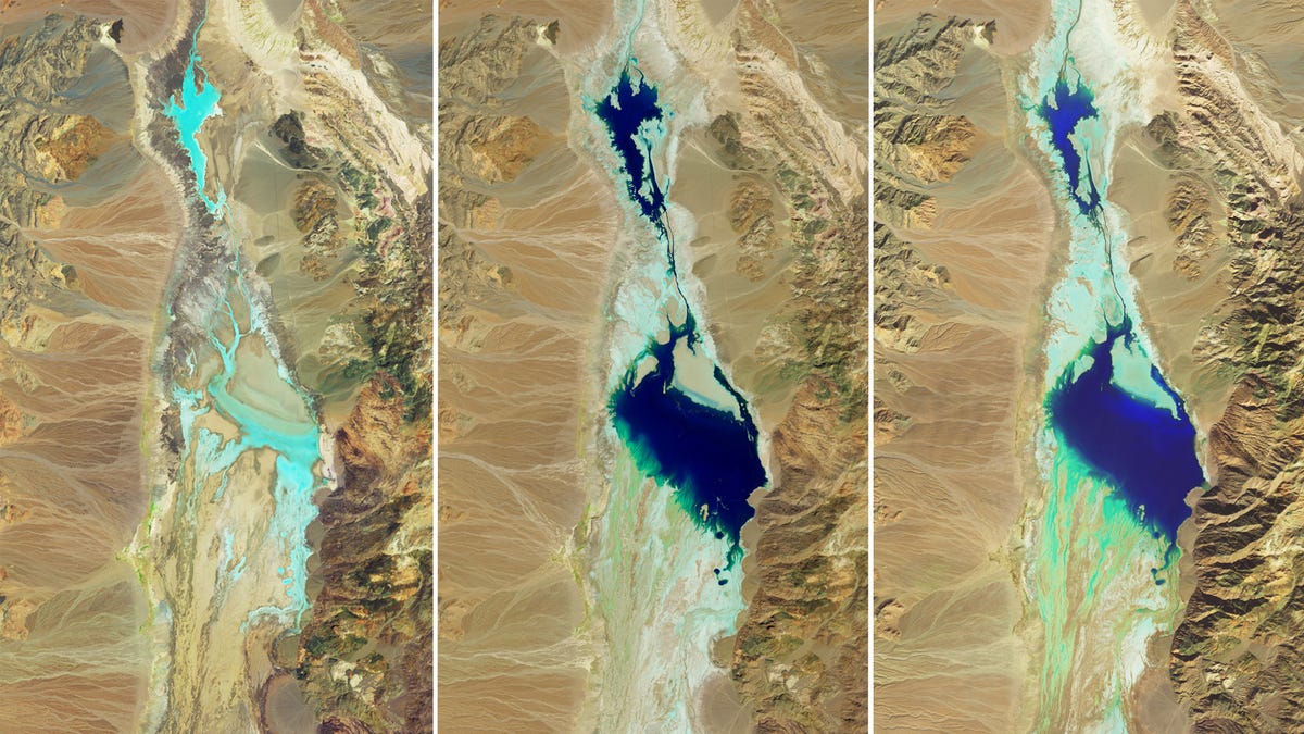
The typically-dry Badwater Basin salt flat at the bottom of Death Valley has for months been teeming with water after record rains and flooding have battered eastern California since August.
Kayakers and nature lovers are flocking to Death Valley National Park in California to enjoy something exceedingly rare at one of the driest places in the United States: Water.
A temporary lake has bubbled up in the park’s Badwater Basin, which lies 282 feet below sea level. What is typically a dry salt flat at the bottom of Death Valley has for months been teeming with water after record rains and flooding have battered eastern California since August.
In the past six months, a deluge of storms bringing record amounts of rain led to the lake’s formation at the park − one of the hottest, driest and lowest-elevation places in North America, according to the U.S. Geological Survey.
Satellite images from NASA show how the lake formed in August in the aftermath of Hurricane Hilary. Though it gradually shrank, it persisted throughout the fall and winter before it was filled back up by another strong Californian storm earlier this month, known as an atmospheric river.


I want to have been there for when badwater basin was named.
“There’s some water in this here basin”
“Yuup, but it’s Bad.”