

cross-posted from: https://lemmy.world/post/19568259
More info here: https://exhibits.stanford.edu/ruderman/catalog/mz230kn1495
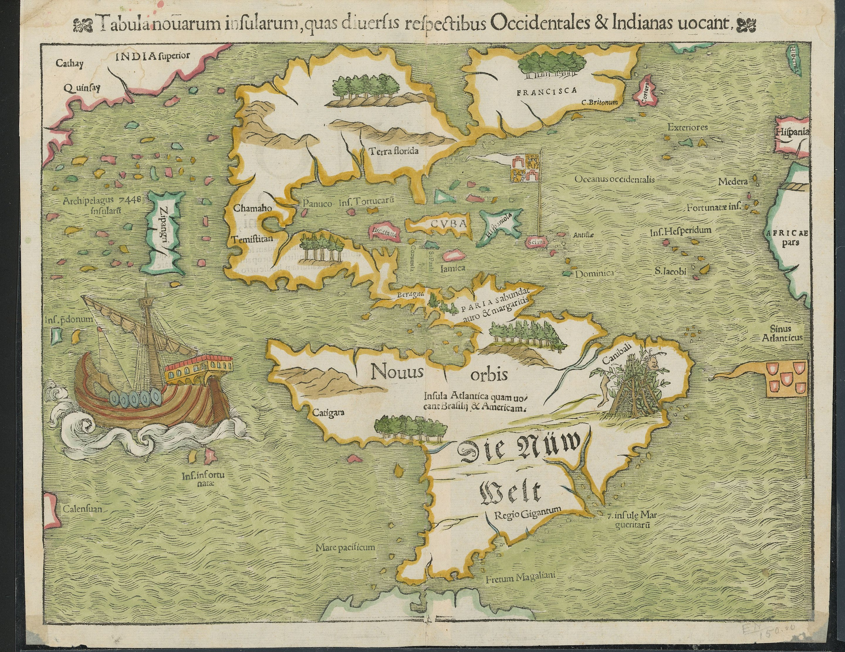
I was trying to figure out what that island labeled Zipangri was supposed to be. At first, I thought it might be Baja California mismapped as an island instead of a peninsula.
A quick online search shows that is supposed to be Japan. Right off the coast of North America.
Let’s not forget that Europeans likely were not knowing California in the 16th century but knew Japan (from travel in the other direction).
Interesting map! Cuba is the only place that appears there with its current name. Funny that the map marks cannibals in the current west of brazil
It is kind of impressive they had this much mapped out when it hadn’t even been 50 years since Columbus’s first voyage.
“Terra Florida”. Flowery Land. Of course.


